AGS Res2D Inv provides accurate 2D resistivity imaging for subsurface exploration and analysis. Its advanced software enables precise geological mapping and helps in identifying hidden structures. AGS Res3D Inv extends this capability with 3D inversion, offering even more detailed subsurface modeling for complex sites.
Efficient Subsurface Investigation by :
AGS Res2D Inv offers high-resolution 2D resistivity imaging, ideal for mapping subsurface geological structures and detecting anomalies. The 3D inversion feature enables users to generate detailed cross-sections and volumetric models, aiding in more precise geotechnical assessments and resource exploration.
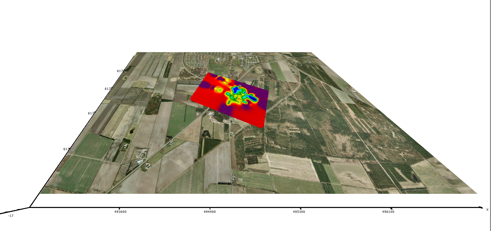
By capturing resistivity data and processing it through sophisticated inversion algorithms, they provide highly accurate visualizations of complex geological formations. These models are crucial for identifying hidden layers, fault lines, and resource deposits, making them invaluable for projects in mining, construction, and environmental studies.
AGS Res2D Inv and 3D Inv empower users with advanced tools for 3D subsurface modelling, delivering a comprehensive understanding of underground structures. With their ability to analyze and map intricate subsurface features, AGS Res2D and 3D Inv enable informed decision-making and reduce uncertainties in geotechnical investigations.
Yes, both tools are designed to adapt to various terrains and complex geological conditions.
Copyright © 2025 Innourbia Solutions Pvt. Ltd. - All Rights Reserved.