Tartget For Arc GIS Pro

Target For ArcGIS Pro – Geosoft

Uncover insights quickly with Target for ArcGIS Pro—enhancing drillhole and subsurface data analysis

Exploring Our Applications :

Effortless Data Collaboration

It integrates surface grids like magnetics, geochemistry, and topography into your models. Also, it adds subsurface slices as section raster data. In addition, it incorporates 3D geological models, wireframes, or Geosoft voxel files seamlessly with drilling datasets.

Special Attributes:

It uses the viewer tool to step through your project section by section. Also, it creates professional-quality maps with ArcGIS Pro’s layout tools. In addition, it builds maps for reports, printing, and PDFs effortlessly.

Let's Connect

Connect with Us

Applications of Target For ArcGIS Pro – Geosoft Software

Geosoft enhances mineral exploration with data visualization and analysis using Esri ArcGIS Pro. Unlock insights for informed decision-making and optimized resource management.

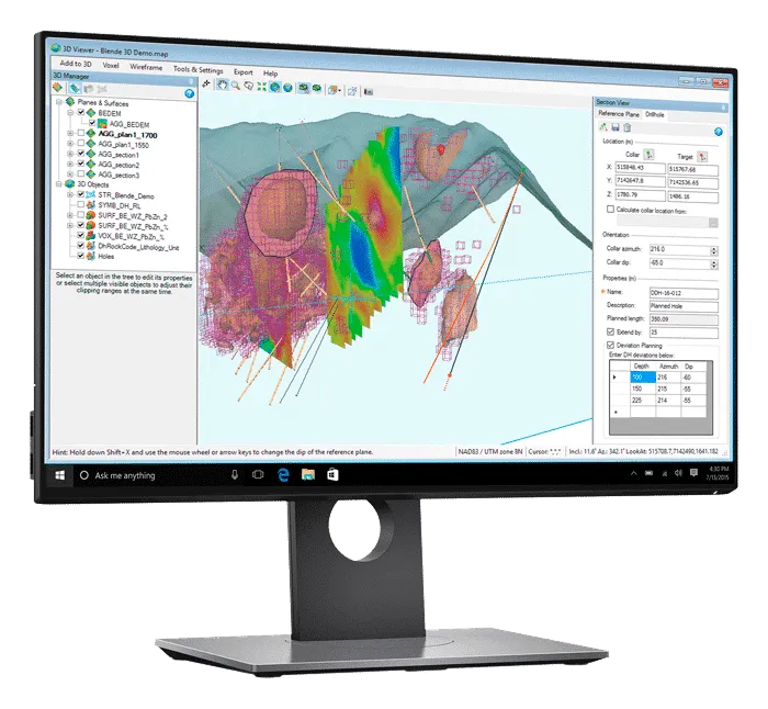
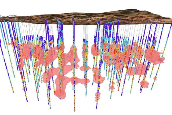
Mineral Exploration - Data Visualisation & Analysis with Esri ArcGIS Pro

Geosoft's services enhance mineral exploration through advanced data visualization and analysis with Esri ArcGIS Pro. We provide integrated mapping and spatial analysis tools for accurate insights. Empower your exploration projects with detailed, data-driven decision-making.

FAQ

Most frequent questions and answers

You can import various file types such as Geosoft, CSV, Excel, MX Deposit, and others.
Yes, ArcGIS Pro users can share projects, maps, or layers with others using Esri ArcGIS Online web-sharing workflows.
Target for ArcGIS Pro supports 3D navigation shortcuts to help you easily navigate subsurface data and clip scene extents to drill hole boundaries.