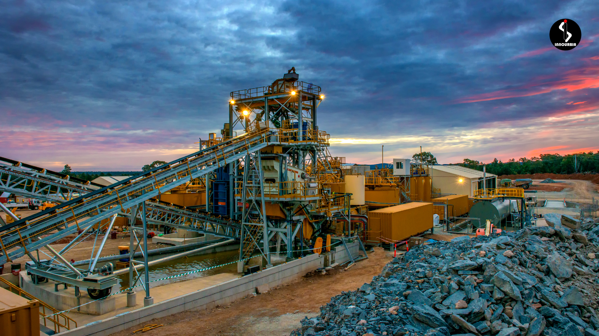
Geophysical surveys are essential in uncovering subsurface conditions that are critical to projects in mining, civil engineering, hydrology, and environmental science. One of the most widely used approaches within this field is profiling, a technique that allows for high-resolution imaging along a survey line to evaluate subsurface features. This blog breaks down the purpose, methodology, and advantages of profiling, helping professionals make informed decisions during early exploration and development phases.
What isIs Profiling in Geophysical Surveys?
Profiling refers to the measurement of variations in physical properties of subsurface materials along a linear path (a “profile line”) using geophysical methods. It involves collecting continuous or spaced measurements along a transect to map structures beneath the surface.
Common profiling methods include:
- Electrical Resistivity Profiling (ERP)
- Seismic Refraction/Reflection Profiling
- Ground Penetrating Radar (GPR)
- Magnetic and Gravity Profiling
- Electromagnetic (EM) Profiling
Each technique captures different properties (e.g., resistivity, seismic velocity, magnetic susceptibility), allowing geophysicists to interpret geological layering, detect faults, locate groundwater, and assess ore mineral potential.
Purpose of Profiling in Geophysical Surveys
1. Subsurface Feature Mapping
Profiling helps delineate geological contacts, structural discontinuities, mineralized zones, and lithological boundaries. For instance, resistivity profiling can distinguish between clay-rich and sandy formations, while magnetic profiling can trace ultramafic rocks or structural offsets in greenstone belts commonly associated with base metal and precious metal deposits.
2. Site Investigation for Infrastructure
In urban planning or construction, profiling determines bedrock depth, soil stratigraphy, and groundwater levels. GPR is especially useful for shallow investigations such as roadbed evaluations or detection of buried utilities. Seismic refraction profiling assists in calculating shear wave velocities crucial for foundation design.
3. Environmental Applications
Profiling helps identify underground storage tanks, landfill boundaries, and zones of groundwater contamination. EM profiling detects conductivity anomalies caused by leachate plumes or saline intrusion. Resistivity methods can delineate the extent of contamination or assess the integrity of containment barriers.
4. Resource Exploration
In mineral exploration, profiling identifies favourable zones for drilling. Seismic profiling is key in coal and oil exploration to map stratigraphic sequences, while electrical resistivity and induced polarization (IP) profiling assist in mapping disseminated sulphide mineralization. Combined with geochemical data, profiling forms a foundation for 3D targeting.
The Process of Profiling in Geophysical Surveys
1. Survey Design
The profile line is planned considering geological targets, access constraints, and desired resolution. Electrode arrays (e.g., Wenner, Schlumberger, Dipole-Dipole) are chosen based on expected target depth and contrast. Denser sampling intervals yield higher resolution but may increase survey time and processing complexity.
2. Data Acquisition
Survey teams use specialized instruments:
- Resistivity meters (e.g., ABEM Terrameter) for multi-electrode measurements
- Seismographs and geophones for seismic profiling
- GPR antennas with varying frequencies for depth and resolution trade-offs
- Proton precession and caesium vapor magnetometers for magnetic surveys
3. Data Processing
Raw field data is processed using advanced software tools. At Innourbia, we use:
- Oasis Montaj (by Seequent) for processing and visualizing magnetic and gravity data
- Imago for integrating field images and core photography with geophysical logs
- Leapfrog and K-MINE for integrating geophysical interpretation with geological and block models
These tools allow geophysicists to enhance signal quality, remove noise, and generate accurate subsurface models.
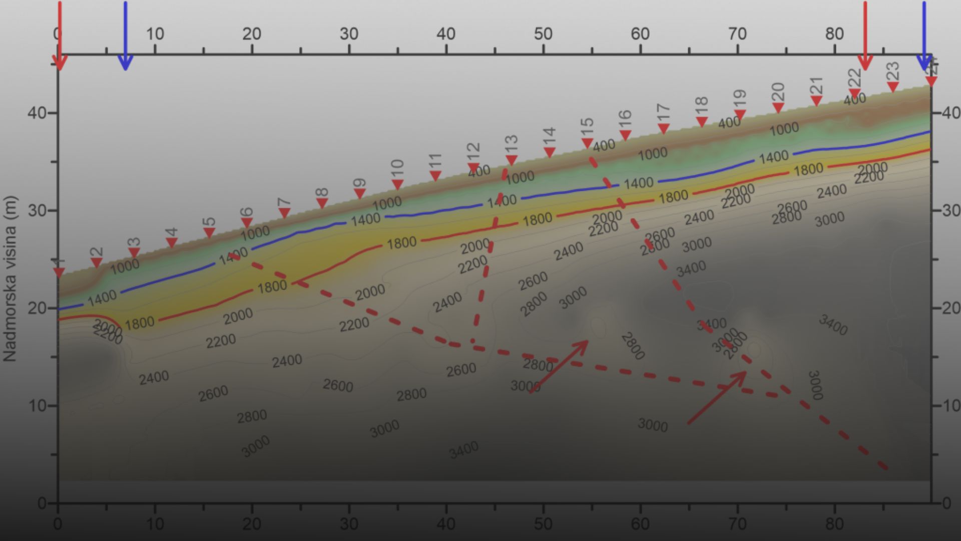
4. Interpretation
Inverted sections and model outputs are interpreted by geophysicists, often in conjunction with geological and drilling data. Profiles can reveal dipping strata, fault zones, ore horizons, and water tables. At Innourbia, our interpretations using Oasis Montaj are cross-validated using Seequent’s Leapfrog for 3D visualization and integration with geological models.
Benefits of Geophysical Profiling
1. High-Resolution Subsurface Imaging
Profiling provides detailed subsurface sections that support precise geological mapping and ore targeting.
2. Cost-Effective and Non-Invasive
It reduces the number of trial drill holes, minimizing expenditure and environmental disturbance.
3. Time-Efficient Field Execution
Modern profiling equipment allows rapid acquisition—e.g., resistivity surveys covering hundreds of meters per day using automated switching units.
4. Adaptability to Complex Environments
Profiling methods work in challenging terrains such as forested areas, rocky outcrops, and urban sites. UAV-mounted magnetometers extend profiling to inaccessible areas.
5. Risk Mitigation and Pre-emptive Planning
Profiling identifies subsurface anomalies—like voids, water pockets, or weak zones—before construction or mining, supporting safer and more efficient designs.
Limitations and Considerations
- Depth penetration is method-dependent (e.g., GPR up to 10m, resistivity up to 200m or more)
- Noise sensitivity from nearby infrastructure or weather conditions can affect data quality
- Single-line profiling may miss lateral variations—dense grids or multiple lines improve model accuracy
Profiling for Smarter Subsurface Insight
Profiling in geophysical surveys offers a powerful, adaptable approach for imaging and analyzing the Earth’s subsurface. Whether applied in mineral discovery, infrastructure development, or environmental monitoring, it supports decision-making with precision and speed.
At Innourbia Solutions Pvt. Ltd., our collaborations with leading platforms such as Seequent (Oasis Montaj, AGS Workbench and Leapfrog, enable us to deliver cutting-edge geophysical solutions tailored to project-specific needs.