Looking for mineral exploration services in Kolkata? Let our experienced team guide you from the ground up.
Approach
Methodical analysis using systematic study patterns for precise, science-driven exploration and understanding
Collaboration
Brining in a collaborative application of industry best practices & norms aided by cutting edge digital tools & solutions, in accordance to international standards.
Research
Thorough research of historical data and effective utilisation of captured & available geological data & information for a scientific and logical interpretation
Database
Data Base Design, Data Capture, Storage and harmonious synchronization with downstream activities
Services
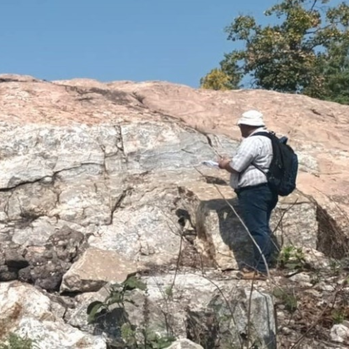
Mapping
Reconnaissance and detailed Geological Mapping, surface and soil sampling, stream sediment sampling, pitting, trenching and sub-surface sampling .
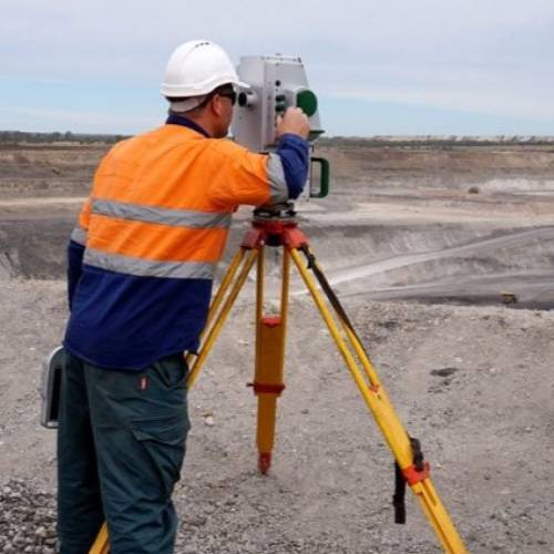
Topographic Survey
Aerial and Ground Survey using DGPS, Total Station and Drone
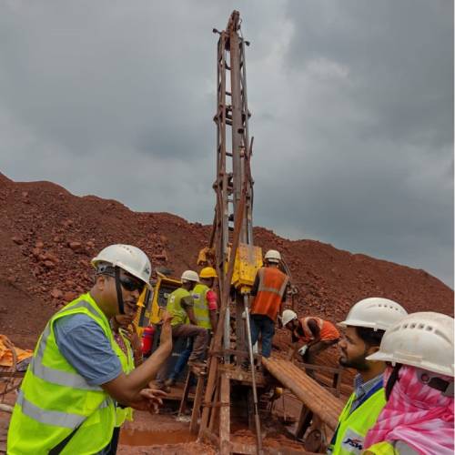
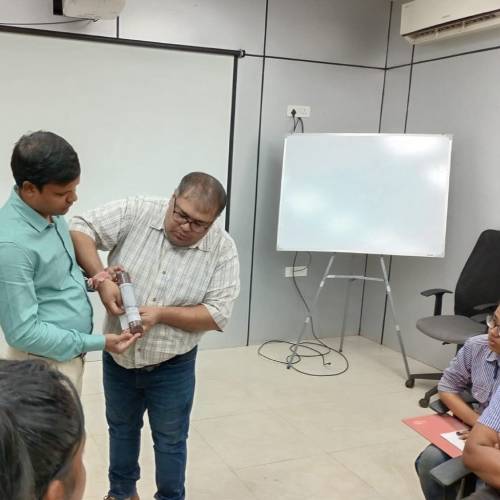
Exploration Management
Planning & Management of Exploratory Drilling (core and non-core both); Drill Core Logging (Lithological & Structural both), sampling, data base management
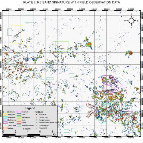
Remote Sensing & GIS
Remote Sensing, GIS and Band Analysis for identification of potential mineralized zone. Digitization and Georeferencing of maps using state of the art GIS solutions, such as ArcGIS, QGIS .
Geotechnical Studies
Being carried out at the exploratory level and also for operational mine pit geotechnical study (Pics from ISPL). RQD; , and measurements for oriented cores and structural plots of these measured geotechnical data; RMR measurements to understand the engineering properties and subsurface conditions of a deposit
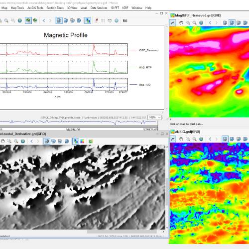
Geophysical Surveys
Ground Magnetic, Gravity and Drone Magnetics studies are being carried out for coal and metal deposits.
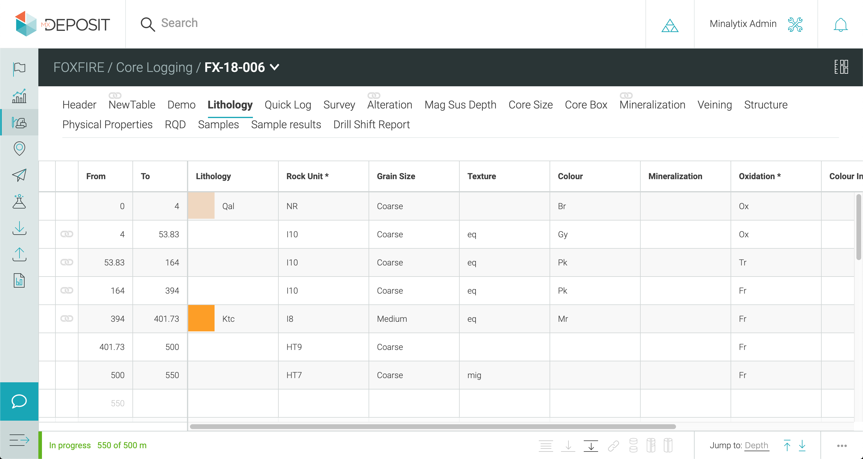
Database Management
Data capture, Database Designing and database Management and collaboration & sharing for exploration database (drill hole data), sampling data, chemical analysis report, core images
Mineral exploration services involve the investigation and analysis of land to discover the presence of valuable minerals. These services include geological surveys, geophysical studies, drilling, sampling, and resource estimation.
At Innourbia Solutions Pvt. Ltd., we provide end-to-end mineral exploration services including geological surveys, geophysical investigations, remote sensing, drilling support, sampling, resource modeling, and feasibility assessments to identify and evaluate mineral deposits.
We are a Kolkata-based geological consultancy with extensive experience in mineral-rich regions across Eastern India. Our expert geologists and engineers use advanced tools and data-driven techniques to deliver accurate, reliable, and sustainable exploration solutions.
We have expertise in the exploration of a wide range of minerals including coal, iron ore, bauxite, limestone, copper, manganese, and rare earth elements, especially in regions like Jharkhand, Odisha, and Chhattisgarh.
Simply reach out to us through our contact page or call us to schedule a consultation. Our team will assess your needs and design a strategic exploration plan aligned with your objectives.